Regional Overview
The “Michinoku” part of the Michinoku Coastal Trail, which stretches a span of 1000 kilometers from north to south, is a catch-all term once used to refer to mainly the Pacific Ocean side of Tohoku. The “Tosando” eastern mountain circuit was one of the five provinces and seven circuits of the Yamato Imperial Court. The part furthest from the capital and north of Fukushima was the end of the circuit and thus called the place at the end of the road, “michi no oku,” which became “michinoku.” The MCT route connects the eastern end of Michinoku, the Sanriku Coast spanning Aomori Prefecture, Iwate Prefecture, and Miyagi Prefecture, to the Oshika Peninsula, the Sendai Plains and beyond.
Natural Environment
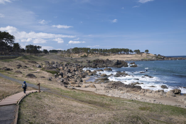
The coastal area from the northernmost point of the MCT in Hachinohe, Aomori to Kesennuma, Miyagi is widely known as “Sanriku.” The northern part of Sanriku hosts a dizzying array of scenery in short sections from rocky areas and sandy beaches to small fishing harbors and fishing villages. To the south, a coastal terrace with a series of dynamic cliffs also known as the “Alps of the Sea.” Then, starting south of Ide River which runs through Miyako City, an intricate series of inlets and capes of a ria coastline, which further south changes to a simple curve along Sendai Bay.
Compared to the Japan Sea and inland areas of Tohoku, the Pacific coast is relatively warm with little snow buildup. Meanwhile, in offshore Sanriku two currents meet: the Oyashio bringing phytoplankton from the north converges with the warm Kuroshio from the south. In early summer, the Oyashio cools wet air flowing from the high-pressure system over the Okhotsk Sea resulting in the cold, wet “yamase” wind.
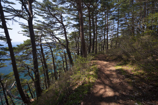
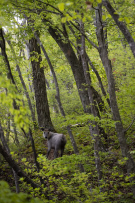
Over the MCT’s 1000 kilometer route, Michinoku reveals a variety of scenery, but its green, fluffy pines are emblematic of Sanriku. In Sanriku, as ocean currents from north and south converge offshore, on land a boundary forms between northern and southern plant life, with the northernmost area of lush evergreen trees on the Pacific side located in this area. Sika deer are often spotted, and black bears also frequently appear in areas where people live.
Route Origins
Kitakami River, the longest river in Tohoku, flows from inland Iwate all the way to Ishinomaki in Miyagi Prefecture. East of Kitakami River lie the relatively gentle slopes of the Kitakami Mountains, and further east is the Sanriku Coast.
Villages and towns line what were two historical roads: the Oshu Kaido crossing up the Kitakami Plains between the Kitakami Mountains and Ou Mountains to the east, and the Hamakaido, which connected coastal villages to each other. The Oshu Kaido, one of the five routes of the Edo period, is now National Route 4, even now acting as a major route between Tohoku and Kansai.
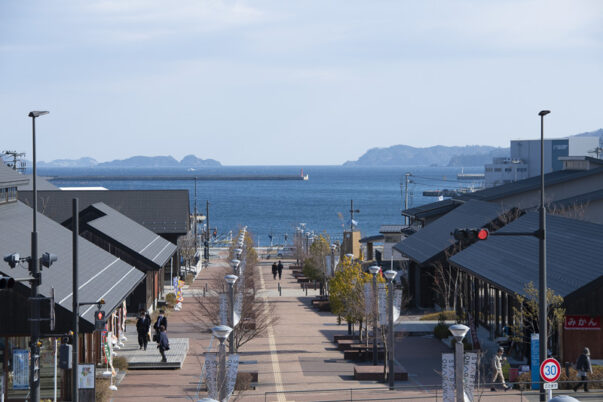
Meanwhile, along the coast, villages came to be in a different context from inland, and the Hamakaido route developed to bring in people and goods from the oceanside. Fishing villages were born, and those areas blessed with rivers or deep harbors then became large harbor towns. The harbor towns of Michinoku were connected to Edo and Kyoto via the sea from the Edo period, with goods and people coming and going.
While people and goods had moved by boat between fishing village and fishing village, and fishing village and harbor town, as this movement became more and more frequent, roads connecting town and village were built. These roads then connected to each other, and this route joining the coastal areas became known as the Hamakaido.
Fishing villages form thanks to a close relationship with the mountains and rivers that support them. People nourish themselves with the blessings of the sea, while timber and fresh water are indispensable to build and maintain boats. Rivers carry nutrients from the mountains lush with deciduous trees to the sea to form fertile fishing grounds with plenty of phytoplankton.
History of Michinoku
People have lived in Michinoku’s coastal areas since the Jomon period. Many Jomon prehistoric sites have been discovered right against the coastline, and the middens there show that people then lived off the blessings of the sea, much as they do in the present day.
During the Yamato dynasty, Michinoku, where the Emishi people lived, was outside the control of the Japanese central government. The dynasty built defense sites throughout Tohoku to strengthen their control over the Emishi. Tagajo Castle, also a place name in Miyagi Prefecture, was one of such defense sites built in the Nara period as a military base. In the middle basin of the Kitakami River between northern Miyagi and southern Iwate, cultures from north and south clashed and in some cases melded together.
After many battles, the Emishi were defeated and brought under control. Toward the end of the Heian period, the Oshu Fujiwara clan governed a wide area of Michinoku based from Hiraizumi. Then Toyotomi Hideyoshi punished the warriors of Oshu, and later the Nanbu clan, Date clan, and Soma clan and others formed the basis of Michinoku’s feudal government period until the Meiji-era abolition of domains and establishment of prefectures.
Hiking Scenery
We will introduce how to hike the Michinoku Coastal Trail in 8 areas.